I’m beginning to discover the beauty of living so close to the equator: the days are not getting shorter as fall progresses, and since seasons practically don’t exist, the weather remains just as warm. While the thought of heat all year long would probably have sent me into infinite suffering in the past, I’m now loving the persistently gentle air and verdant greens!
Life 🌇
As I’ve acclimated to the weather, I find myself excited to explore all that this island has to offer. At the suggestion of Clayton, fellow BUDS lab member Synne and I tried dragon boating. There are many dragon boat teams in Singapore, including a significant group of teams organized by expat communities (American, Canadian, German, Filipino, Celtic…). We chose to join the Canadian team for a trial practice, and arrived at their boathouse near Kallang River Saturday afternoon. After some mingling with current members, we were given oars and life jackets. A lovely woman showed us the basics of a dragon boat stroke (the body should resemble an A, the oar should be perpendicular with the water throughout each stroke), and then we went on the water! The experience reminded me of a lot of rowing in high school: we first rowed in pairs, then fours, then everyone in the boat all together. There was a coxswain giving instructions, and the rush of the boat created a nice rhythm with our strokes. We eventually made it to Marina river, and enjoyed a beautiful view of Marina Bay Sands and Gardens by the Bay. Afterwards, we celebrated a team member's birthday with lemon poppyseed cake, and socialized over 100Plus (Singapore’s most popular sports drink?) and beer.


I’ve also connected with fellow Fulbrighters in Singapore thanks to a US embassy event at the Hard Rock Cafe. It was comforting to be with a group of Americans, eating burgers, nachos, brownies, and drinking chocolate milkshakes in strong air conditioning, talking and talking and talking. Perhaps it was my childhood in Xi’an or my Asian American identity, I never thought I had much in common with the stereotypical American. Yet being in Singapore has made me realize that unknowingly I’ve become American in the way I see the world and conduct myself: in comparison to my generally polite and reserved Singaporean colleagues and friends, I’m extroverted, rambunctious, talkative. I never thought I’d find small talk about family members, weekend activities, or just general life details to be so interesting, but at Hard Rock Cafe, these conversations made me feel at home.
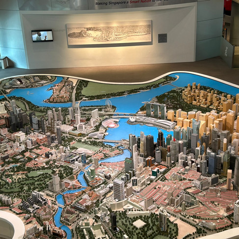
I visited Tanglin again the next day to mail my absentee ballot from the American Embassy, and in proper daylight the poshness of the area struck me. On my bus ride from Clementi to Tanglin, the prevailing HDB flats (subsidized units developed by the government) gradually turned into upscale condos, and the sidewalk demographics changed from elderly people in flip flops to well-dressed professionals. As I passed by maids doting on children with golden curls and blue eyes, I couldn’t help but ponder on the dichotomy of lifestyles in Singapore: you can eat a meal at Hawker centers for $5, but you can also visit a Michelin-starred restaurant and easily spend hundreds of dollars; local schools provide rigorous education at heavily subsidized prices (government schools charge less than $35 per month), yet there is also a plethora of international schools that have annual tuition as high as $50,000; you can feel like you live in South East Asia, or life can be the exact same as the one you enjoyed in New York City, complete with pilates, happy hours, and Chobani yogurt!
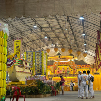
For now, I’m perfectly happy enjoying my Hawker meals and exploring all the uniquely Singaporean sites. I’ve had the chance to visit the Botanical Gardens, Jurong Gardens, and Haw Par Villa. Last weekend, fellow Fulbrighter Jenny Silver and I also checked out Singapore Design Week exhibitions in New Bahru and the National Library. Cranbrook grad Yashma Sonora reached out, so we had a wonderful dinner reminiscing about dorm sign-ins and work duties. In addition, I’m reading up on the different types of food in Singapore (especially Malay and Indian dishes) so I can make more educated picks when faced with unlabeled dishes at Hawker stalls!😆


Research 📝
While I was exploring personal thermal comfort datasets collected via Cozie, I was also thinking generally about the problem of uncomfortably hot outdoor spaces. As of right now, I conceptualize the problem space as a series of links between data and design solutions. If we know the microclimate measurements for every location in a city for all hours in a year, we can easily identify the places that are the most prone to heat stress. With these locations, we can test out design solutions, gather new microclimate measurements, and continuously iterate upon the solutions.
There is however, one big problem: it’s nearly impossible to measure microclimate data for every location for all hours. So we don’t know exactly where we should make interventions, and it’s difficult to evaluate intervention effectiveness even when we make them. A lot of researchers are tackling the data issue from both the time resolution and the space resolution. I met with a few of them at NUS, and their techniques generally involve some combination of advanced interpolation and/or proxy data. For example, Kunihiko Fujiwara trained a deep learning model to predict air temperature, relative humidity, wind speed, and global horizontal irradiance from street view images and satellite images. Pengyuan Liu et al. used a GeoAI model to predict dynamic pedestrian outdoor comfort along a walking route, and Marcel Ignatius et al. theorized how physiological data and street view images can be integrated into a digital twin to unveil pedestrian comfort. While most of this research is limited in geographical scope, I’m certain that with a lot more data collection and training we will be able to accurately predict microclimate parameters.
However, a lot of times the answer to these very advanced research set-ups is simply: shade makes people and places less hot. So for the past weeks, I tried to understand the more nuanced components of these conclusions. For example, is there discrepancy between predicted variables and human thermal perception? Kunihiko kindly shared his model with me, and I was able to play around with it and attempted to find correlations between his model outputs and Cozie datasets. Since his model was trained on street images, I hoped that I can also learn more about different shading types and their impact on comfort, for example, Is the shading provided by trees more comfortable than that provided by buildings? Unfortunately, the correlation between predicted microclimate features and individual thermal responses are weak. There are many reasons for this: there is not enough street view images or thermal preference responses, comfort depends on multiple variables and I didn’t combine the predicted variables to estimate Universal Thermal Climate Index (a common thermal perception indicator), I only tested correlation between responses from Cozie thermal comfort surveys and air temperature for a specific hour instead of simulating air temperature at times that the surveys were taken… When I discussed my findings with Clayton, he suggested that I take a look at the other end of problem space: if we had all of the microclimate data, how would we make this information actionable for designers and planners?

Image from Microclimate Vision: Multimodal prediction of climatic parameters using street-level and satellite imagery (Kunihiko et al. 2024)
To understand this final link between information and action, I went down a rabbit hole of existing heat mitigation planning strategies and how urban designers engage with microclimates. According to an empirical study of built environment professionals’ perceptions in South Wales by Ryan McNeilly Smith, many architects, urban designers, and planners feel like there’s a lack of government regulation on heat mitigation and thus many don’t know what the best practice for designing comfortable streetscapes is nor how they should implement it. Further, many expressed that they lack data on how their past projects affected the environment and communities, and thus are uncertain about the effectiveness of their current design and planning strategies. This is oddly similar to many conversations I’ve had in the AEC realm about feedback loop: unlike other product industries, there’s very little emphasis on feedback and improvement for buildings. Instead of perfecting a single product (take an app like Uber, the engineers and designers are constantly gathering user information to improve upon their services), architects are constantly designing new projects. Even if some knowledge is transferable from project to project, the push for novelty and new forms makes it difficult to reuse and refine past strategies and leave architects little time and desire to study the performance of past projects.
Although I don’t have a solution to improve the feedback loop (other than to build the same building over and over again, which I’m sure architects are not okay with), I began to wonder how to establish a more effective, data-driven urban design and planning framework. To learn more about existing planning frameworks, I read a review paper on strategies for urban heat island mitigation, as well as a highly-cited framework paper on planning for cooler cities. Briony Norton et al. outline a 5 step mitigation framework that starts from city scale and gradually narrows down to microscale. It was interesting reading about their decision making process, which is based on table values (for example, the prioritization table lists prioritization values based on canyon width and canyon height). I think that a digital tool can greatly improve this process by automating street prioritization and listing possible mitigation strategies, so I wanted to learn more about the capabilities of digital twins as well as their current use cases in Singapore. Marcel Ignatius and Joie Lim, who both work on the Cool NUS Beam Initiative, kindly showed me their digital twin prototype. While the prototype does not yet have predictive capabilities, it can visualize existing conditions and cozie data quite well. One of the features is an interpolated microclimate map for the entire NUS campus, which has been used to determine hot spots on campus. Marcel also gave me examples of heat mitigation projects that emerged from microclimate analysis, and it was very insightful to hear real world considerations when choosing mitigation strategies. For example, it was not possible to plant more trees in certain hot spots, so they instead applied cool paint on facades. Other times, they opted for cool pavement as there were a lot of exposed spaces such as parking lots.


Additionally, I was fortunate to have lunch with Justin Foo (Cornell B.Arch 2018) and his colleague Kelvin Li, who serve as Executive Architect and Executive Engineer respectively at the Urban Redevelopment Authority (URA). URA is the national urban planning authority of Singapore, and their responsibilities include land-use planning, urban design, and evaluating and approving development projects for both the public and private sectors. Both Justin and Kelvin have been a part of URA efforts on heat mitigation and heat resilience planning, and they shared with me typical workflows as well as how they ensure that developers follow their outlined practices. Since in Singapore most land is held by the State, URA is able to research site-specific sustainability and heat mitigation strategies and set them as requirements when developers bid for sites and projects. Justin showed me an amazing outdoor space outside of Guoco tower, which is shaded by a high canopy and surrounded by vegetation. He explained that the space was unfit for high-rise development since it is on top of subway tracks, so the URA required it to be developed into a public green space (as opposed to letting the developer do whatever they want, which might have resulted in low-rise buildings or very commercial oriented plaza with no greenery or shading). I think the power to execute a central vision is perhaps one of the biggest differences between the US and Singapore. In my limited experience in the New York AEC industry, while there is a gradual increase in regulations that require sustainability compliance (Local Law 97 sets emission limits for large buildings), there is no way to enforce site-specific interventions.
After all my rabbit hole chases, I'm left with more questions than answers. Maybe I could help Kunihiko refine his microclimate vision project, or investigate how digital tools can be used for heat mitigation? It would also be interesting to review the existing heat mitigation frameworks and how they were applied, and for this I can focus on Singapore in particular, or compare and contrast between Singapore and Hong Kong, Australia… When I presented all options to Clayton in our weekly meeting, he summarized the exploration phase as getting pulled in 10 directions, and pulling myself in 10 other directions. And when I expressed some anxiety about the fuzziness of all these directions, as well as the fear of not having enough work if I don’t figure things out now, he commented about how a big part of research is embracing the fuzziness. The traditional education system trains us to measure progress in a very specific way (often through assignments and grades), but research and real life often does not progress in linear ways. Sometimes we need to fail to move forwards, or to just swim around in fuzziness before anything clicks. This sounds quite scary, but for now I’m trying to embrace it.
Fun🍪
I want to start leaving a cookie crumb trail of things I’ve found interesting or inspiring:
The best career advice I’ve read: Wait but Why
I got consoled by an older version of myself: Future You by MIT Media Lab
Interactive and fun design: Talia Cotton’s website
Before you go, humor me and guess what the prices of these dishes are in US dollars! You can hover on the image to reveal the answer.


And last but not least, I leave you with my sightings of Singapore's cheeky otters:
I have earned more about Singapore through your articles and can’t wait to go there! Enjoy your life and research there and look forward to your wonderful articles and beautiful photos